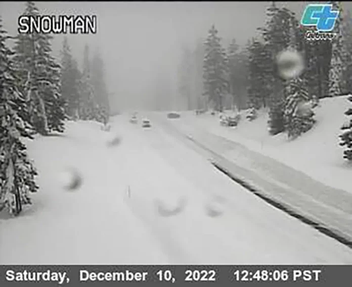
A winter storm that sent ski lift chairs swinging and closed mountain highways in the Sierra Nevada will push across the United States and reach the Plains by mid-week, bringing significant rain and below-average temperatures.
Marc Chenard, a meteorologist at the National Weather Service at the national center in College Park, Maryland, said, “it will be a busy week while this system moves across the country.”
Heavy snow fell in the Sierra Nevada while downpours at lower elevations triggered flood watches Sunday across large swaths of California into Nevada.
The Heavenly ski resort at Lake Tahoe shut down some operations when the brunt of the storm hit Saturday. The resort posted a video of lift chairs swaying violently because of gusts that topped 100 mph (161 kph), along with a tweeted reminder that wind closures are “always for your safety.”
To the south, Mammoth Mountain reported that more than 20 inches (51 cm) of snow fell Saturday, with another 2 feet (.6 meters) possible as the tail end of the system moved through the eastern Sierra.
A 70-mile (112-km) stretch of eastbound U.S. Interstate 80 was closed Saturday “due to zero visibility” from the northern California town of Colfax to the Nevada state line, transportation officials said. Chains were required on much of the rest of I-80 and other routes in the mountains from Reno toward Sacramento.
Many other key roads were closed because of heavy snow, including a stretch of California Highway 89 between Tahoe City and South Lake Tahoe, the highway patrol said.
The U.S. Forest Service issued an avalanche warning for the backcountry in the mountains west of Lake Tahoe where it said, “several feet of new snow and strong winds will result in dangerous avalanche conditions.”
Gusts up to 50 mph (80 kph) that sent trees into homes in Sonoma County north of San Francisco on Saturday could reach 100 mph (160 kph) over Sierra ridgetops on Sunday, the National Weather Service said.
Heavy rain was forecast through the weekend from San Francisco to the Sierra crest, with up to 2 inches (5 cm) in the Bay Area and up to 5 inches (13 cm) at Grass Valley northeast of Sacramento.
Warnings and watches were also up across Southern California, as heavy rain caused localized flooding in greater Los Angeles.
“Significant travel delays possible with accumulating snow on several mountain roads. This could include the Tejon Pass and Grapevine area of Interstate 5,” the National Weather Service’s LA-area office said in a statement.
Forecasters in Arizona issued a winter storm watch for northern and central Arizona beginning Sunday evening for areas above 5000 feet (1,525 meters), including Flagstaff, Prescott, and the Grand Canyon, where icy temperatures and up to a foot of snow was predicted.
Republished with the permission of The Associated Press.


